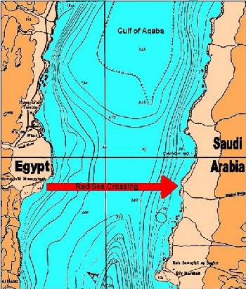
If the Israelites had attempted to cross anywhere else along the Gulf of Aquaba, they would have been faced with an extremely steep descent of about one mile, similar to a steep mountain side. For the Children of Israel with their animals and wagons this very steep descent would have been extremely difficult and dangerous.
A map showing the shallow route for the Exodus Crossing Only at this particular site, on the shores of Nuweiba, does the ‘pathway’ descend at a gradual gradient of one in fourteen, to a depth of just over 850 meters. This depth is confirmed in naval charts of the area. Indeed, the water is even now marked as shallow by several marker buoys, to indicate a warning of the shallow water to passing cargo ships, as they travel up to Eilat.
On the Saudi side the slope climbs again at a gradient of one in ten. The Bible records this in Isaiah 43:16, 17: “Thus says the LORD, who makes a way in the sea, and a path through the mighty waters,” NKJV.